Trails · 8 min read
The Best Hikes in Alberta and BC: 8 Day Trips and Two Big Ones Worth the Sweat
Real distances, real elevation, real permit rules for the standout trails worth your boots this summer.
If you want the best hikes in Alberta and BC, the good news is you are spoiled for choice and the bad news is so is everyone else. The trailheads that used to be a quiet secret now come with shuttle bookings, day passes, and a 7 a.m. scramble on a reservation site. None of that is a reason to stay home. It just means a bit of planning between you and the kind of payoff that makes you forget your knees for a few hours.
I have done most of these in runners I should not have worn and one of them twice in the same week because I am not very smart. Here is the honest rundown: distance, elevation, the season window, and what you actually need to book before you go. Hiking in BC and Alberta rewards the people who read the fine print, so let us get into it.
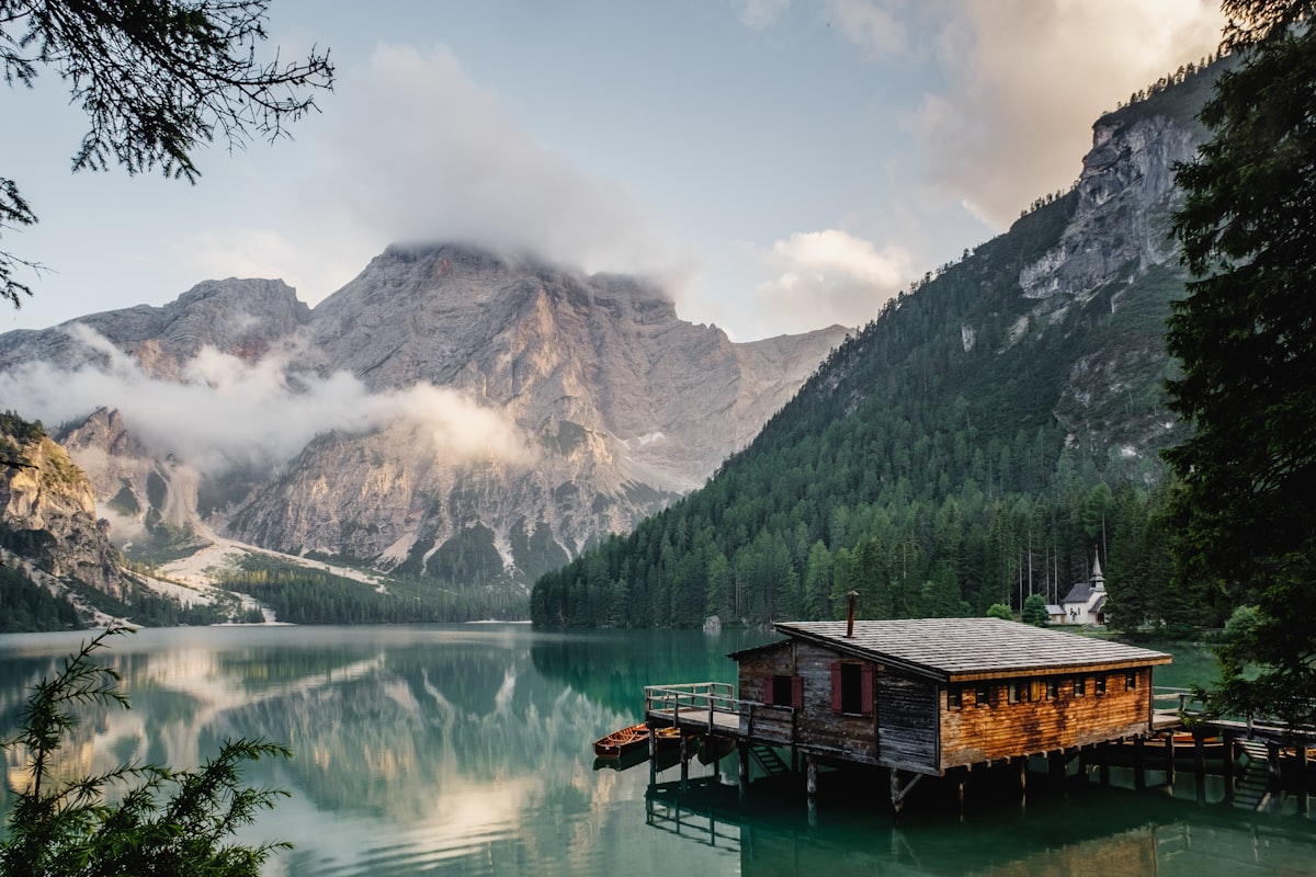
The Lake Louise Tea House Loop (Plain of Six Glaciers + Lake Agnes)
This is the one you send your in-laws on, and they come back converts. From the Chateau, the Plain of Six Glaciers trail runs about 14.2 km return with roughly 590 m of gain to a tea house perched under the Victoria Glacier, where they will hand you a pot of loose-leaf and a slice of something while you watch ice calve off the wall. Tie in Lake Agnes Tea House and the Big Beehive on the way back via the Highline and you are looking at a 20 km day with close to 1,000 m of gain. Bring cash. The tea houses do not take cards because everything, including the propane, is packed in by hand or helicopter.
Best window is late June through September. No reservation to hike, but parking at Lake Louise fills before sunrise, so book the Parks Canada Lake Louise shuttle or get there obscenely early.
Sentinel Pass via Larch Valley (Moraine Lake)
Larch Valley in the third week of September is the most photographed patch of gold in the country, and once you have stood in it you will understand the fuss. The full route to Sentinel Pass is about 11.5 km return with roughly 725 to 800 m of gain, most of it front-loaded in switchbacks above Moraine Lake. The pass itself sits at 2,611 m, the highest you can get on a maintained trail in Banff, and the drop down the far side into Paradise Valley is a proper jaw-dropper.
Two bits of fine print. First, Larch Valley is prime grizzly country, and Parks Canada often imposes a tight group restriction in larch season, sometimes a hard minimum of four hikers travelling together, with fines if a ranger catches you short. Check the Banff trail conditions report before you go. Second, you cannot drive to Moraine Lake. The road has been closed to private vehicles year-round since 2023, so you need the Moraine Lake shuttle, which runs June 1 to mid-October and sells out the instant larch weekend bookings open.
Wilcox Pass (Columbia Icefield)
If you want big-mountain scenery for not much effort, this is the trade of the trip. Wilcox Pass is about 8 km return to the pass with around 335 m of gain, and within the first twenty minutes you are looking straight across the valley at the Athabasca Glacier and the icefield, often with bighorn sheep loafing on the trail like they own it. The red Parks Canada chairs near the top are a fair turnaround for most people. Go July through September; this is high, exposed alpine and it holds snow late. Skip it past the chairs in winter conditions because the upper slope is avalanche terrain.
The Iceline Trail (Yoho)
This is my pick for the single best day of glacier views in the Rockies, and it is on the BC side. The classic Iceline loop from the Takakkaw Falls parking lot runs about 20 km with roughly 1,090 m of gain, climbing onto a raw moraine bench right below the Emerald Glacier before dropping through the Little Yoho Valley past Laughing Falls. There is a shorter 13.6 km out-and-back if your legs are negotiating. The trail usually melts out by early July and stays good into late September. No permit for the day hike, but the access road off the Trans-Canada has switchbacks tight enough that long trailers are not allowed, and the road itself only opens once it is clear of snow, typically late June.
Joffre Lakes (the day-pass trail)
Three stacked glacier-fed lakes, each a more absurd shade of blue than the last, on a trail that is about 10 km return with roughly 400 m of gain near Pemberton. The catch is that Joffre Lakes is the poster child for BC's day-pass system. You need a free BC Parks day-use trail pass for every person, required May 11 to October 25, 2026, released online two days ahead at 7 a.m. and gone in minutes on summer weekends. Note too that the park, known by its Líl̓wat name Pipi7íyekw, closes entirely June 20 to 27 and again September 8 to 30, 2026 for First Nations cultural practices, so build your dates around that. It is busy and it is managed for a reason. Go on a weekday in the shoulder season if you can.
Garibaldi Lake (Sea-to-Sky)
The milky-blue lake at the foot of the Garibaldi massif is one of the great rewards of hiking in BC, and it makes you work for it: about 18 km return from the Rubble Creek trailhead with roughly 820 m of gain through switchbacks that do not let up. Strong hikers push on to Panorama Ridge for the postcard, which turns it into a very long day. Snow lingers up here, so July through September is the honest window. Garibaldi also runs a free day pass, required June 12 to October 12, 2026 on Fridays through Mondays and holidays, with no pass needed Tuesday to Thursday. Plan midweek and you skip the lottery entirely.
The Stawamus Chief (Squamish)
The Chief is the giant granite dome looming over Squamish, and bagging all three peaks is a workout disguised as a hike: about 6.8 km for the First, Second, and Third Peak loop with around 900 m of gain crammed into stairs, roots, chains, and ladders. The exposure on the Second Peak chains is real, so it is not the day to bring nervous first-timers. The payoff is Howe Sound laid out below you and rock climbers dangling off the face you just walked up the back of. Lower elevation means it is hikeable most of the year, though the granite gets greasy and dangerous when wet. Save it for a dry day.
The Big Ones: Berg Lake and the Skyline
When you have a few days, two trips stand above the rest, one in each province.
The [Berg Lake Trail](https://bcparks.ca/mount-robson-park/berg-lake-trail/) in Mount Robson Provincial Park is back. After the 2021 floods tore it apart, it was rebuilt in three phases and fully reopened in 2025, so 2026 is its second complete season. The route runs roughly 21 km one-way to a turquoise lake sitting directly beneath the largest peak in the Canadian Rockies, with the Valley of a Thousand Falls along the way. You must hold a camping reservation for one of the backcountry campgrounds; bookings opened December 2, 2025 for the May 27 to September 29 season, and with only about 100 tent pads a night it is one of the most competitive permits in the country.
Over in Alberta, the [Skyline Trail](https://parks.canada.ca/pn-np/ab/jasper/activ/passez-stay/arrierepays-backcountry/sugg-sentiers_trip-ideas/skyline) in Jasper is the classic three-day ridgewalk, about 44 to 46 km point-to-point with a bit over 1,400 m of total gain, spending more time above treeline than almost any trail in the Rockies. The Notch, at around 2,500 m, is the high point and the spot most likely to be snowbound into July. The trail was swept by the 2024 Jasper wildfire and has since been rehabilitated and reopened for 2026; the park itself is firmly back open, with the main corridors running normally. You need a Parks Canada backcountry permit, and reservations open in late January and vanish in minutes, so set an alarm.
A Few Things That Will Save Your Trip
Book the permits and shuttles first, then plan the rest of the trip around them. Carry bear spray and know how to use it, because every trail on this list runs through grizzly or black bear country. Start early, both for parking and for afternoon thunderstorms that build fast over the alpine. And check the official conditions page the night before, because a trail being world-famous does not stop it from being closed for a washout or a sow with cubs. The mountains keep their own schedule. Your job is to show up ready and let them do the rest.
Before you head out
Need gear for the trip — something built for the bush and made for the long haul? Have a look at what we make.
Shop EVOLVEThe EVOLVE outdoors list
The best places to get outside in Canada — in your inbox.
Trail notes, ski intel, cabins worth the drive, and parks worth the detour. About twice a month. We won’t flood your inbox, and you can leave anytime.
More from the journal